Tatranská magistrála – Long-distance trail (High Tatras)
Trail: Jalovec – Podbanské – Štrbské pleso tarn – Hrebienok – Zelené pleso tarn – Kopské sedlo saddle – Ždiar
Estimated hike duration: The whole trail is 80 km long and it is possible to complete it in a few days.
Height difference: 3,400 m
Difficulty: The hike includes very easy parts as well as challenging transitions for experts.
Note: Tatranská magistrála is a red-marked path which starts in the Western Tatras and continues across the High Tatras into the Belianske Tatras. The route runs on the south side of the mountain range parallel to the main ridge. It is the longest continuous hiking trail in the Tatras. The total length is about 80 kilometers and it is possible to complete the hike in 3-4 days.
Section I: Jalovec – Podbanské: Length 23 km, elevation 700 m, duration 8-9 hours.
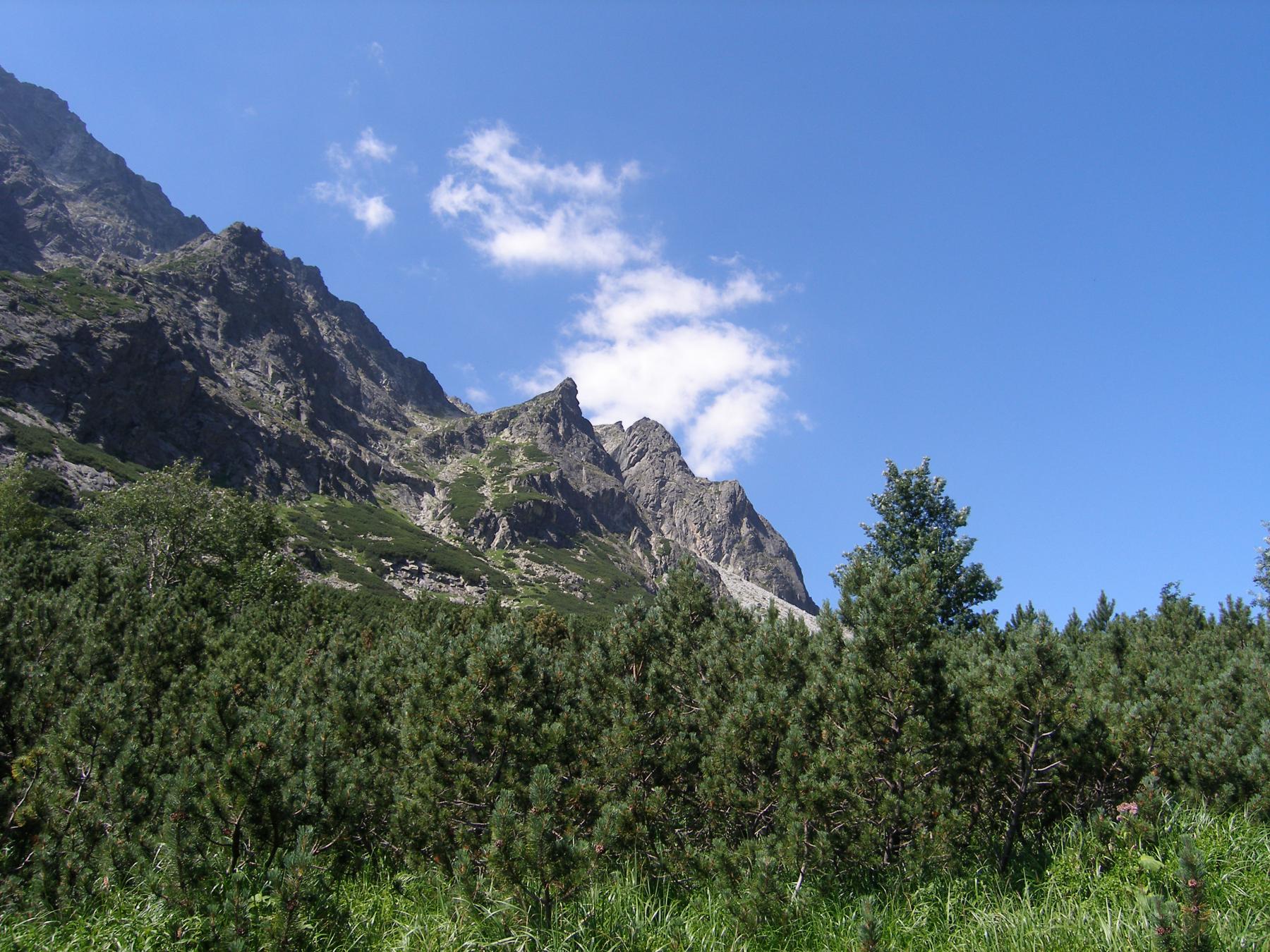
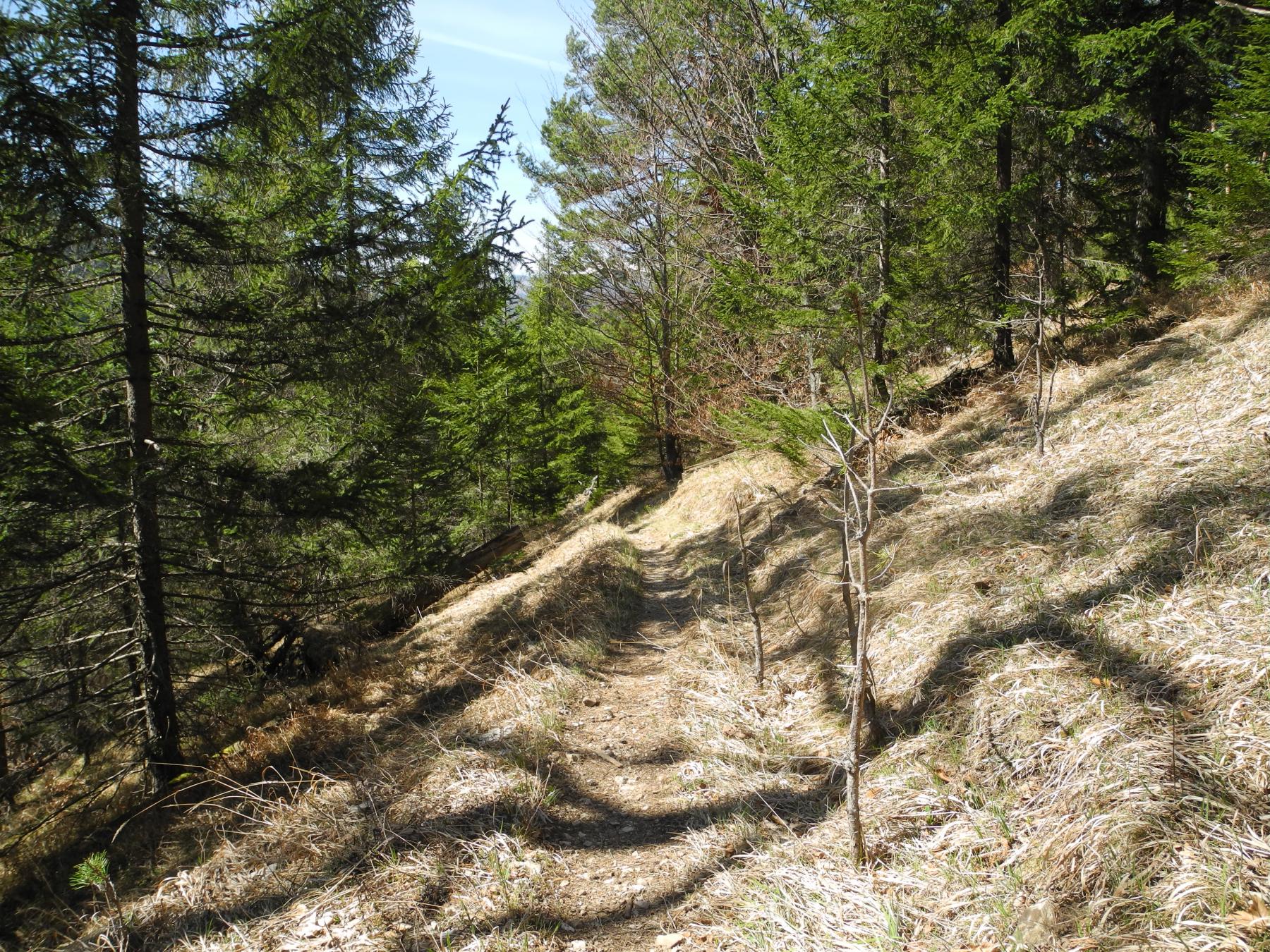
The whole route leads below the Western Tatras and it is a simple trail with a beautiful view of the valleys of the Western Tatras (Jalovecká, Žiarska, Jamnická, Račkova, Bystrá and Kamenistá). We also walk below some great peaks: Baranec, Volovec, Bystrá, and Ostredok. This section can be completed in Podbanské, below Kriváň, which is the first peak of the High Tatras.
Section II: Podbanské – Popradské pleso tarn: Length 20 km, elevation 930 m, and duration 7-8 hours.
Starting in Podbanské, passing by Tichá and Kôprová dolina valley and below Kriváň peak, we reach Jamské pleso tarn, then Štrbské pleso tarn, and finally Popradské pleso tarn. You will be able to see the beauty of the western part of the High Tatras with a view of the Furkotská, Mlynická, Mengusovská and Zlomisková valleys, above which some of the most famous peaks of the High Tatras, Rysy and Vysoká, rise.
Section III: Popradské pleso tarn – Hrebienok: Length 15 km, elevation 750 m, and duration 6-7 hours.
This section is quite demanding, especially at the beginning, when it is necessary to ascend from Popradské pleso tarn to the saddle below Ostrva. The height difference is approximately 550 m here. We are then offered a wonderful view of the Mengusovská and Zlomisková valleys, Satan, and Vysoká. Continuing bellow the Končistá massif across the Štôlská valley we get to Batizovské pleso tarn, from where there is an indescribable view of the highest peak in Slovakia, Gerlachovský štít. We go past the top of Gerlach and come to the Velická valley, where we can have a snack at the Sliezsky dom mountain hotel. From here, the last section along the foothills of Slavkovský štít peak to Hrebienok awaits us.
Section IV: Hrebienok – Ždiar: Length 23 km, elevation 1,300 m, and duration 10-11 hours.
This is a beautiful but also long and challenging section of the eastern part of the High Tatras where we will see the Veľká and Malá studená dolina valleys. We get to Skalnaté pleso tarn, then ascend to the top of Veľká Svišťovka (2038 m) and descend to the valley of Zelené pleso tarn, where we can have some rest in a beautiful mountain hut. After that we climb to Kopské sedlo saddle by Biele plesá tarns, from where we can admire the Belianske Tatras. Having crossed Široké sedlo saddle, we get to the picturesque Goral village of Ždiar.
The trail was prepared by Kubinský Marcel, marcel@kubinsky.sk
Kriváň peak (2,495 m) (High Tatras)
Trail: Bývalá Važecká chata – Tri studničky – Krivánsky žľab gorge – Kriváň peak and back
Estimated hike duration: 4-5 hours ascent, 3-4 hours descent (altogether: 8-9 hours)
Height difference: 1,355 m
Difficulty: An all day hike for physically fit tourists.
Note: It is possible to do a circle tour from Štrbské pleso tarn or to choose another starting point.
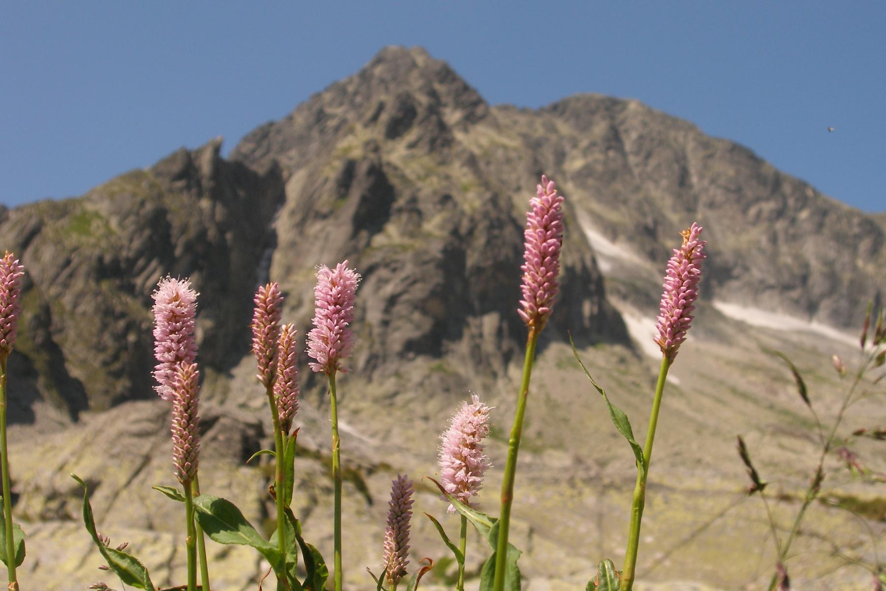
From the parking situated by Bývalá Važecká chata we continue to a place called Tri studničky. Next we walk up the forest above the Kôprová dolina valley. There is a bunker from the time of the Slovak National Uprising in 1944 by the path, which we can visit. In the area above Grúnik, we leave the forest zone and get into the mountain pine trees zone which opens up to beautiful views. We continue along the rocks to Krivánsky žľab gorge to cross the southeast ridge by which we ascend to the top reaching Malý Kriváň peak first, then crossing Daxnerove sedlo saddle until we finally get to the top of Kriváň, which is considered a symbol of Slovaks. From the top, we get to see the entire High and Western Tatras. In the south, we can see the Low Tatras and, in the west, the Malá and Veľká Fatra mountains.
The trail was prepared by Kračmer Peter, kracmer@skialpkrivan.sk


Štrbské Pleso – Rysy mountain (2,503 m) – Štrbské Pleso (High Tatras)
Trail: Štrbské Pleso – Popradské pleso tarn – Chata pod Rysmi mountain hut – Rysy mountain – Popradské pleso tarn – Štrbské Pleso
Estimated hike duration: 4-5 hours ascent, 4-5 hours descent (altogether: 8-10 hours)
Height difference: 1,290 m
Difficulty: A difficult climb suitable for moderately experienced hikers, there is a passage with chains and steel climbers on the trail.
Note: The trail can also start from the Tatra Electric Railway stop – TEŽ Popradské pleso.
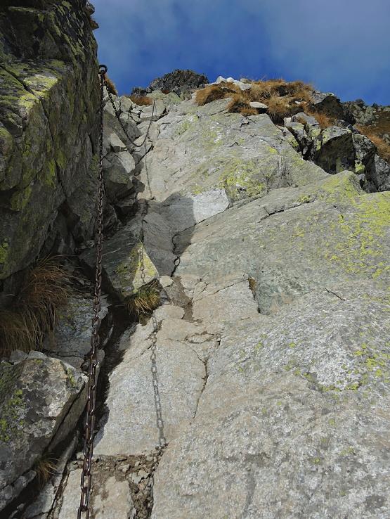
The hike begins in Štrbské Pleso (1,355 m) from where we go up a slight hill to Trigant hill. We continue along the contour to Popradské pleso tarn. As we get to the crossroads, we turn towards the Mengusovská dolina valley. We then get to three tarns called Žabie plesá from where we go up the secured passage above the rock sill to Chata pod Rysmi mountain hut (2,250 m). At this point, the most difficult part of the hike is behind us.
The first part of the final climb leads to Váha saddle (2,340 m) from where we can enjoy of a picturesque view to the Bielovodská dolina valley and to Galéria Ganku (2,461 m). When in the saddle, we turn to climb up the ridge and we get under the peak of the Rysy mountains (2,503 m) by a narrow traverse. After about one hour of walking from the mountain hut, we can benefit from a magnificent view of Morské oko tarn, Czarny staw (the tarn at the Polish side) and adjacent peaks from the top of the mountain. It is possible to return the same way.
The trail was prepared by Kubinský Marcel, marcel@kubinsky.sk


Rysy mountain from the Polish side (High Tatras)
Trail: Lysá Poľana (PL-SK border) – Morské oko tarn – Rysy mountain (2,499 m) and back
Estimated hike duration: 5-6 hours ascent, 4-5 hours descent (altogether: 10-12 hours)
Height difference: 1,650 m
Difficulty: A difficult climb suitable for moderately experienced hikers; there is a long passage with chains and steel climbers on the trail, it is very difficult to descend with chains.
Note: Let's get to the highest point of Poland on this one-day hike to Rysy in the High Tatras. Enjoy some of the most picturesque mountain sceneries on your way to the summit on the border of Slovakia and Poland. Rysy mountain is located in the main ridge of the High Tatras mountain range, right on the border of Slovakia and Poland. At 2,499 meters, Rysy is the tallest peak of Poland, and even has an additional peak on the Slovak side. It is a popular hike for all the adventurers and travelers. During summer, it offers multiple paths to get to the summit that vary in time and difficulty. Being surrounded by the lakes and wildlife as you climb makes this a once-in-a-lifetime experience showing you the beauty of two countries.
Our hike starts at Palenica Bialczanska (1,000 m). We walk to the largest tarn in the High Tatras, Morskie Oko, and then ascend to the second-deepest tarn, Čierne pleso. The scenery around the tarns gives you a chance to explore the remote nature of Poland at first hand. The next part of our ascent is a technically difficult hike which includes a long section with chains. The reward for our hard work is reaching the summit of Rysy and its unique panoramas.
After a short break at the peak, we can choose to return to Palenica Bialczanska the same way we came with a break at a mountain hut at Morskie Oko or we can also hike down the Slovak path past Popradské pleso tarn to Štrbské Pleso to experience both sides of the mountain.
The trail was prepared by Kubinský Marcel, marcel@kubinsky.sk


Štrbské Pleso – Furkotský štít peak (2,405 m) – Štrbské Pleso (High Tatras)
Trail: Štrbské Pleso – Mlynická dolina valley – Furkotský štít peak – Furkotská dolina valley – Štrbské Pleso
Estimated hike duration: 4-5 hours ascent, 3-4 hours descent (altogether: 7-9 hours)
Height difference: 1,000 m
Difficulty: An all-day hike suitable for more experienced hikers.
Note: Beginning in Štrbské Pleso, we ascend on the path of the Mlynická dolina valley. After around one hour, we get to a wonderful waterfall called Skok (Jump). From above the waterfall, we get to see a spectacular panorama. After a short break, we walk through the great meadow of mountain flowers and small rivers. At the end of the valley, the trail leads us to Capie pleso tarn (2,225 m). The winding path takes us from the tarn under the saddle called Bystrá lávka from where we continue to Furkotský štít peak. The spectacular view of the Tatras from there is definitely worth visiting. On our way back we can see Wahlenbergher tarns. On the way down we can stop by Chata pod Soliskom, a mountain hut, and from there we get to Štrbské Pleso. This hike is only possible with an international mountain leader as it leads beyond the marked trails of the national park.
The trail was prepared by Marcel Kubinský marcel@kubinsky.sk


Štrbské Pleso – Bystrá lávka saddle – Mlynická & Furkotská valleys (High Tatras)
Trail: Štrbské Pleso – Mlynická valley – Bystrá lávka saddle – Furkotská dolina valley – Štrbské Pleso
Estimated hike duration: 3.5-5 hours ascent, 3-4 hours descent (altogether: 7-9 hours)
Height difference: 930 m
Difficulty: An all-day hike suitable for more experienced hikers as some sections are secured with chains.
Note: Beginning in Štrbské Pleso, we get to the turn to the Mlynická valley and after one hour to a wonderful waterfall called Skok (Jump). From above the waterfall, there is a spectacular panorama. After a short break, we walk on the great meadow of mountain flowers and small rivers. At the end of the valley, the trail leads us to Capie pleso tarn (2,225 m). The winding path takes us from the tarn to the saddle called Bystrá lávka (2,300 m) which is secured by chains. We then descend to the Furkotská dolina valley from where we can see Wahlenbergher tarns. On our way back, we can stop by Chata pod Soliskom mountain hut and from there we get to Štrbské Pleso by a cable car.
The trail was prepared by Marcel Kubinský marcel@kubinsky.sk


Štrbské Pleso – Kôprovský štít peak (2,363 m) – Štrbské Pleso (High Tatras)
Trail: Štrbské Pleso – Above Popradské pleso tarn – Hincovo pleso tarn – Vyšné Kôprovské sedlo saddle – Kôprovský štít peak
Estimated hike duration: 4-5 hours ascent, 3-4 hours descent (altogether: 7-9 hours)
Height difference: 1,168 m
Difficulty: An all-day hike suitable for more experienced hikers.
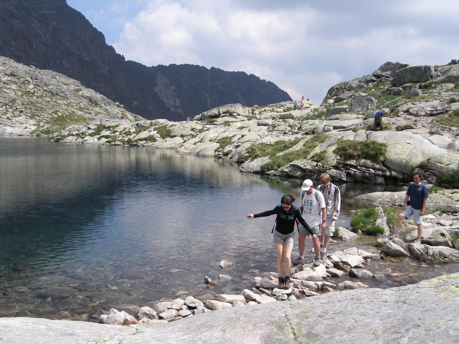
Note: Beginning in Štrbské Pleso, we follow the Tatranská magistrála trail. We continue upwards until we get below the Patria massif which offers a spectacular panorama. Soon we get to the turn to the valley called Mengusovská dolina. We can take a break at one of the two mountain huts by Popradské pleso tarn. The trail in the Mengusovská dolina valley leads us to Veľké Hincovo pleso – a beautiful tarn that is the biggest and the deepest mountain lake in the Slovak High Tatras. Its surface area is 20 ha and the maximum depth is 53 meters. The winding path takes us from the tarn to the saddle called Vyšné Kôprovské sedlo from where we continue to the top of Kôprovský štít peak. The spectacular view of the Tatras from there is definitely worth visiting. On our way back we can take another break at Popradské pleso tarn. The trail can also start from the Tatra Electric Railway stop – TEŽ Popradské pleso.
The trail was prepared by Dušan Burian; Marcel Kubinský: dusanbur@gmail.com; marcel@kubinsky.sk


Končistá peak (2,537 m) (High Tatras)
Trail: Sliezsky dom mountain hotel (1,670 m) – Batizovské pleso tarn (1,884 m) – Končistá peak (2,537 m) – back to Sliezsky dom mountain hotel (another option is to descend across Lúčne sedlo saddle (2,168 m) – Tupá peak ( 2285 m) – sedlo pod Ostrvou saddle (1,984 m) – Popradské pleso tarn – Tatra Electric Railway stop, TEŽ Popradské pleso (1,250 m))
Estimated hike duration: 3-4 hours ascent, 2.5-3 hours descent (or 3-4 hours descent for the second option across Tupá peak)
Height difference: 1,100 m
Difficulty: A moderately difficult hike beyond the marked trails; the overall length of the hike is approx. 15 km.
Note: Končistá is the highest peak in the southern part of the main ridge of the High Tatras. It towers from Popradský Ľadový štít peak. The ridge of Končistá separates the Batizovská dolina vallley and the Štôlska dolina valley. On the top of Končistá, we can find a rock formation called "Jármayho stôl" (Jármay's table) or "Nákova" (Anvil). In 2019, it was struck by a lightning which broke the rock leaving only two-tirds of it on the top of the peak. The other third lies in the glen below the mountain. Končistá offers a stunning panoramic view of the Batizovská dolina valley, Gerlachovský štít peak, the Dračia dolina & Mengusovská dolina valleys.
During the first part of the hike, we follow the path of Tatranská magistrála trail (until we get to Batizovské pleso tarn and descend to Sedlo pod Ostrvou saddle). The second part of the trail is beyond the marked trails. In order to ascend to Končistá, you should already have some experience with all day hikes with high elevation gains, for example to Rysy mountain, Jahňací štít peak, etc. It is one of the most beautiful hikes in the Tatras offering stunning views and allowing hikers to gain experience in moving beyond the marked trails.
The trail was prepared by Kubinský Marcel, marcel@kubinsky.sk


Východná Vysoká peak (2,429 m) (High Tatras)
Trail: Tatranská Polianka – Sliezsky dom – Poľský hrebeň saddle – Východná Vysoká peak and back
Estimated hike duration: 4-5 hours ascent, 3-4 hours descent (altogether: 8-9 hours)
Height difference: 1,434 m
Difficulty: A difficult climb for experienced hikers, certain passages are secured with chains.
Note: The hike can also start in Tatranské Zruby, Nový Smokovec or Starý Smokovec.
From the parking in Tatranská Polianka we start hiking along the Velický potok stream to Sliezsky dom (mountain hotel), where it is possible to have a snack. We continue along Velické pleso tarn and Večný dážď waterfall, then above Velický waterfall until we reach Kvetnica. This is where the Velická valley opens up to us. We continue under the massif of the Gerlachovský štít peak and along Dlhé pleso tarn to Poľský hrebeň saddle. The difficult section secured by chains starts here under the saddle. The final ascent to the top includes a short section secured with chains. At the top we can enjoy a beautiful panoramic view of all the dominant peaks of the High Tatras.
The trail was prepared by Kračmer Peter, kracmer@skialpkrivan.sk


Slavkovský štít peak (2,452 m) (High Tatras)
Trail: Starý Smokovec – Slavkovská vyhliadka (overlook) – Slavkovský nos peak – Slavkovský štít peak and back
Estimated hike duration: 4-5 hours ascent, 3-4 hours descent (altogether: 8-9 hours)
Height difference: 1,477 m
Difficulty: An all day hike for physically fit tourists.
Note: The hike begins in the center of Starý Smokovec. We start to hike slightly through the forest to the area of five springs (Päť prameňov) and continue in the direction of the overlook called Slavkovská vyhliadka which offers the first views from heights. We continue along a rocky path ascending to Štrbavý hrebeň ridge below which there is a path leading across the Slavkovský nos peak to the top of the Slavkovský štít peak. It is an extensive massif between the Veľká Studená valley and Starý Smokovec. The top offers views of the entire High Tatras. In the south, we can also see the Low Tatras.
The trail was prepared by Kračmer Peter, kracmer@skialpkrivan.sk


Starý Smokovec – Zbojnícka chata mountain hut (1,960 m) – Starý Smokovec (High Tatras)
Trail: Starý Smokovec – Hrebienok – Zbojnícka chata (mountain hut) – Hrebienok – Starý Smokovec
Estimated hike duration: 3-4 hours ascent, 2-3 hours descent (altogether: 5-8 hours)
Height difference: 780 m
Difficulty: A slightly difficult climb suitable for moderately experienced tourists; two sections are secured with chains.
Note: It is possible to take a funicular from Starý Smokovec to Hrebienok or in the opposite direction (the price for the funicular is not included).
Located in one of the most beautiful valleys in the High Tatras of Slovakia, Zbojnícka chata mountain hut (1,960 m) is a great place for a hike offering some of the best views in the entire Tatras mountain range.
We can start either in Starý Smokovec (1,000 m) or Hrebienok (1,285 m) and continue to Reinerova chata mountain hut (1,300 m). It is one of the oldest huts in the High Tatras. From there we hike to the Veľká studená dolina which is a nearly 8 km long valley. On the way you can admire up to 23 mountain lakes. The next part of the hike includes two relatively easy sections with chains. When we finally reach Zbojnícka chata mountain hut, we get to relax, enjoy the views and have some snack before we head back.
This hike is a great opportunity for anyone who would like to explore the High Tatras. It is open all year round so you can choose your favorite season and take a trip during a sunny summer day, in colorful autumn or even in the snow.
The trail was prepared by Marcel Kubinsky, marcel@kubinsky.sk


Starý Smokovec – Téryho chata mountain hut (2,015 m) – Starý Smokovec (High Tatras)
Trail: Starý Smokovec – Hrebienok – Zamkovského chata mountain hut – Téryho chata mountain hut - Zamkovského chata mountain hut – Hrebienok – Starý Smokovec
Estimated hike duration: 3-4 hours ascent, 2-3 hours descent (altogether: 5-8 hours)
Height difference: 1,005 m
Difficulty: A slightly difficult climb suitable for moderately experienced tourists.
Note: It is possible to take a funicular from Starý Smokovec to Hrebienok or in the opposite direction (the price for the funicular is not included).
From Starý Smokovec we go up the trail alongside the funicular or we take it to Hrebienok. Then we go down to the Studenovodské vodopády waterfalls, walk around them and get to the oldest mountain hut in the High Tatras – Reinerova chata. After a short break we walk around a big waterfall to Zamkovského chata mountain hut. We zigzag along the stream across the valley called Malá Studená dolina. In the middle of the valley, we start going up into Veľký hang, a scree hillside. Below the peak of Žltá stena we get to Malý hang hillside and soon to Téryho chata mountain hut (2,015 m). After a little snack, we take a look at the basin called Kotlina Piatich spišských plies (The Basin of Five Spiš tarns) and we go back following the same trail.
The trail was prepared by Marcel Kubinsky, marcel@kubinsky.sk


Malá studená dolina valley – Priečne sedlo saddle – Veľká studená dolina valley (High Tatras)
Trail: Hrebienok – Zamkovského chata mountain hut – Malá studená dolina valley – Priečne sedlo saddle – Veľká studená dolina valley – Zbojnícka chata mountain hut – Hrebienok
Estimated hike duration: 9-12 hours
Height difference: 1,200 m
Difficulty: A difficult climb suitable for physically fit and experienced hikers; there is a passage with chains and steel climbers.
Note: The trail can also start from Starý Smokovec, but it is a bit longer from there.
Spend a day exploring the beautiful High Tatras along the scenic "Eagle path". You will be surrounded by gorgeous landscape – different peaks, valleys, tarns, and waterfalls. Although the hike is pretty strenuous, all the magnificent views are definitely worth it.
We can start either in Starý Smokovec (1,000 m) or Hrebienok (1,285 m). We cross Starolesnianska poľana meadow (1,300 m) and enter the Malá studená dolina valley passing by Zamkovského chata mountain hut (1,450 m) and later by Téryho chata mountain hut (2,015 m) where we can take a break and have some snacks. We continue along the five Spiš tarns and get to Modré pliesko tarn (2,250 m) which is the highest mountain lake in the Tatras. The most challenging section secured with chains leads us to Priečne sedlo saddle (2,352 m) from where we descend to the Veľká studená dolina valley. After some rest and snacks at Zbojnícka chata mountain hut (1,960 m), we descend to Hrebienok or to Starý Smokovec.
The trail was prepared by Kubinský Marcel, marcel@kubinsky.sk


Hrebienok – Prielom saddle – Poľský hrebeň saddle – Hrebienok (High Tatras)
Trail: Hrebienok – Zbojnícka chata mountain hut – Prielom saddle – Poľský hrebeň saddle – Sliezsky dom mountain hotel – Hrebienok
Estimated hike duration: 9-11 hours
Height difference: 1,090 m
Difficulty: A quite difficult hike across two mountain saddles secured with chains and metal ladders suitable for fit and moderately experienced tourists.
Note: It is possible to take a funicular from Starý Smokovec to Hrebienok or in the opposite direction (the price for the funicular is not included).
From Hrebienok (1,255 m) we ascend across the Veľká studená dolina valley to Zbojnícka chata mountain hut (1,960 m) where we can have some snacks before we head for Prielom saddle (2,288 m), a part of the main ridge of the High Tatras. After a slightly difficult descent to the Zamrznutý kotol valley using chains, we ascend back to the main ridge, to Poľský hrebeň saddle (2,200 m). We can have a short break here before we descend across the Velická dolina valley passing by Dlhé & Velické pleso tarns to Sliezky dom mountain hotel (1,670 m). We can have some rest here and then, following the path of Tatranská magistrála trail, we return to Hrebienok. The most difficult sections of the trail are secured with chains. It is also possible to hike in the opposite direction starting from Hrebienok and continuing to Sliezsky dom mountain hotel.
The trail was prepared by Marcel Kubinsky, marcel@kubinsky.sk


Skalnaté pleso tarn – Veľká Svišťovka – Zelené pleso tarn (High Tatras)
Trail: Tatranská Lomnica (Skalnaté pleso tarn) – Veľká Svišťovka peak – Mountain hut at Zelené pleso tarn – back to Tatranská Lomnica
Estimated hike duration: 6-8 hours
Height difference: 1,260 m (370 m ascent, 1,260 m descent)
Difficulty: A slightly difficult hike suitable for moderately experienced tourists.
Note: With so many great places to explore in the High Tatras, it is hard to decide where to go. This all day hike will take you to the peak of Veľká Svišťovka (2,038 m) and to the beautiful valley of Zelené pleso tarn. The hike begins in Tatranská Lomnica (850 m) from where we walk to Skalnaté pleso tarn (1,750 m). For this part of the trail, it is also possible to use a cable car instead of walking. We then continue to the peak of Veľká Svišťovka. Even though it is not the highest one in the Tatras, it offers one of the best panoramic views. Having enjoyed the scenery, we make our way down to the valley of Zelené pleso tarn. During the descent, we need to get through a 50 meters long passage secured with chains. Once we get to the valley, we stop at the mountain hut at Zelené pleso tarn where we can have lunch and enjoy great views. We then go back to Tatranská Lomnica or to Biela Voda bus stop from where it is possible to take a bus to Tatranská Lomnica.
The trail was prepared by Marcel Kubinský, marcel@kubinsky.sk


Jahňací štít peak (2,230 m) (High Tatras)
Trail: Kežmarská Biela voda – Šalviový prameň stream – Mountain hut at Zelené pleso tarn – Jahňací štít peak and back
Estimated hike duration: 4-5 hours ascent, 3-4 hours descent (altogether: 8-9 hours)
Height difference: 1,365 m
Difficulty: An all day hike for physically fit tourists; the trail includes sections that are secured with chains.
Note: It is also possible to start the hike in Tatranské Matliare or to choose another access path.
From Kežmarská Biela voda parking we slightly ascend on the forest path in the Biela voda valley. We continue across the Šalviový prameň stream and get to the valley of Zelené pleso tarn. Walking along the Zelený potok stream, we get to the mountain hut at Zelené pleso tarn. Jastrabia veža peak makes the panoramic view there even better. It is possible to get something to eat at the mountain hut before the ascent or on our way back. From the hut we continue to the Červená dolina valley. Passing by Červené pleso and Belasé pleso tarns we ascend to Kolový priechod saddle. This is where we can find the first sections secured with chains. It is not too far from the peak but the terrain gets rougher and more difficult here. The peak offers spectacular views of the nearby Belianske Tatras, the northern High Tatras, Poland, and prominent Lomnický štít peak.
The trail was prepared by Kračmer Peter, kracmer@skialpkrivan.sk


Jahňací štít peak across Kopské sedlo saddle (High Tatras)
Trail: Tatranská Kotlina – Plesnivec mountain hut – Veľké Biele pleso tarn – Kopské sedlo saddle – Jahňací štít peak – Mountain hut at Zelené pleso tarn – Biela voda
Estimated hike duration: 5-7 hours ascent, 5-6 hours descent (altogether: 10-13 hours)
Height difference: 1,470 m ascent, 1,320 m descent, altogether 2,790 m
Difficulty: A difficult climb for experienced hikers, certain passages comply with the 1st degree of “Scale of Difficulty” – international mountain climbing scale of UIAA (International Union of Alpine Associations).
Note: It is possible to divide the climb into two days. The first day would comprise ascending to Plesnivec mountain hut and the mountain hut at Zelené pleso tarn. The second day we would climb to the peak and then descend.
The hike begins in Tatranská Kotlina and continues to Plesnivec mountain hut (1,290 m) in the Belianske Tatras mountain range along the green-marked trail under Bujačí vrch hill across the Rakúska poľana clearing towards Veľké Biele pleso tarn and then to Kopské sedlo saddle (1,778 m): 2-2.5 hours. From there to the north-east, we follow the unmarked trail of Jahňací hrebeň ridge across Jahňací hrb peak (1,924 m), afterwards we climb the narrow traverse of the north-west wall to get about 100 m below the peak and join the yellow-marked trail from where we move directly to the top of Jahňací štít peak (2,230 m): 2-2.5 hours.
We descend along the yellow-marked trail across Kolové sedlo saddle to the Červená dolinka valley, the mountain hut at Zelené pleso tarn and the Šalviový prameň stream crossroads. After that we follow the blue-marked trail to get to Biela voda bus stop.
The trail was prepared by Hric Roman, hric.roman40@gmail.com


Zelené, Biele & Trojrohé pleso – tarns (High Tatras)
Trail: Biela voda – Biele pleso tarn – Mountain hut at Zelené pleso tarn – back to Biela voda
Estimated hike duration: 3-4 hours ascent, 2.5-3 hours descent (altogether: 5-7 hours)
Height difference: 730 m
Difficulty: A slightly difficult climb suitable for moderately experienced tourists.
Note:
Let's explore three tarns in one day (Zelené pleso, Biele pleso and Trojrohé pleso) while enjoying some lovely views, diverse fauna and flora and granite and limestone mountains.
From Biela voda, we hike up to the Šalviov prameň stream (1,210 m) and then continue to Biele pleso tarn (1,625 m) beneath the limestone hills of the Belianske Tatras. We take the path with a beautiful scenery from Biele pleso tarn to Trojrohé pleso tarn. The last stop is the mountain hut at Zelené pleso tarn (1,550 m) where we can have something to eat.
The trail was prepared by Marcel Kubinsky, marcel@kubinsky.sk


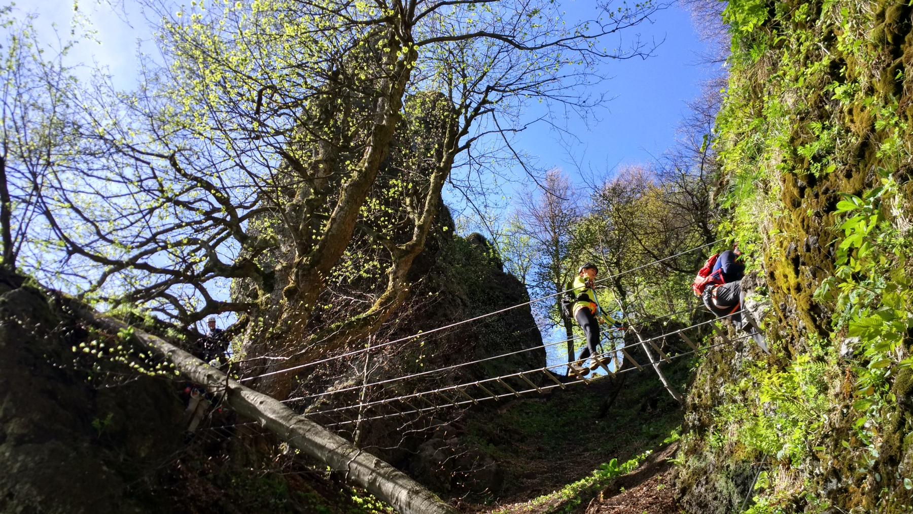
Via Ferrata of the Mountain Rescue Service (High Tatras)
Trail: Tatranská Kotlina – quarry
Estimated hike duration: 1-2 hours ascent
Height difference: approx. 400 m
Difficulty: A moderately difficult via ferrata for physically fit tourists.
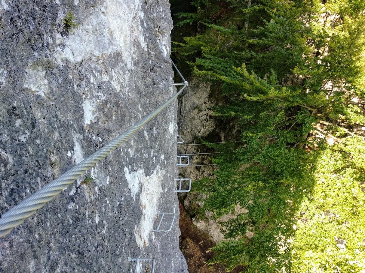
A major part of the trail on our way up is the via ferrata situated on the rocky walls and provided with the technical equipment (steel ropes, iron cramps, climbers). It is necessary to have a via ferrata kit (seating harness, helmet, energy absorber, gloves) – it is possible to borrow it on the spot. The trail is also suitable for children over 10 years of age.
Note:
This location is also suitable for via ferrata training courses from beginners to advanced.
The Via Ferrata of the Mountain Rescue Service in Tatranská Kotlina is the oldest Slovak via ferrata. It was built by the Mountain Rescue Service for trainings. It is mostly natural with only a few artificial elements (only two iron cramps and three climbers). At one point, it splits into two parts and we cross both of them one by one. Both variants are about 200 m long and their difficulty is C. We then follow the descent path.
The via ferrata is also suitable for beginners. A mountain leader can acquaint you with the via ferrata equipment, methods and techniques.
The trail was prepared by Kračmer Peter, kracmer@skialpkrivan.sk


Via Ferrata Veľký Kyseľ – Slovenský raj (Slovak Paradise)
Trail: Čingov tourist area (or Letanovský mlyn) – Veľký Kyseľ gorge, return to the starting point of the hike past Kláštorisko tourist area
Estimated hike duration: 2.5-4 hours ascent (altogether 6-8 hours)
Height difference: 600 m
Difficulty: A moderately difficult climb, the track is secured with the technical equipment (ropes – via ferrata), bridges, chains and ladders.
Admission fee: 5€/person – paid to the administration of the national park for the passage through the via ferrata
Note: A mountain leader can belay you in case you feel insecure crossing the gorge (via ferrata). Belaying makes the crossing much safer especially for the less experienced hikers and for children. Via Ferrata Veľký Kyseľ is closed every year from November 1 to June 14.
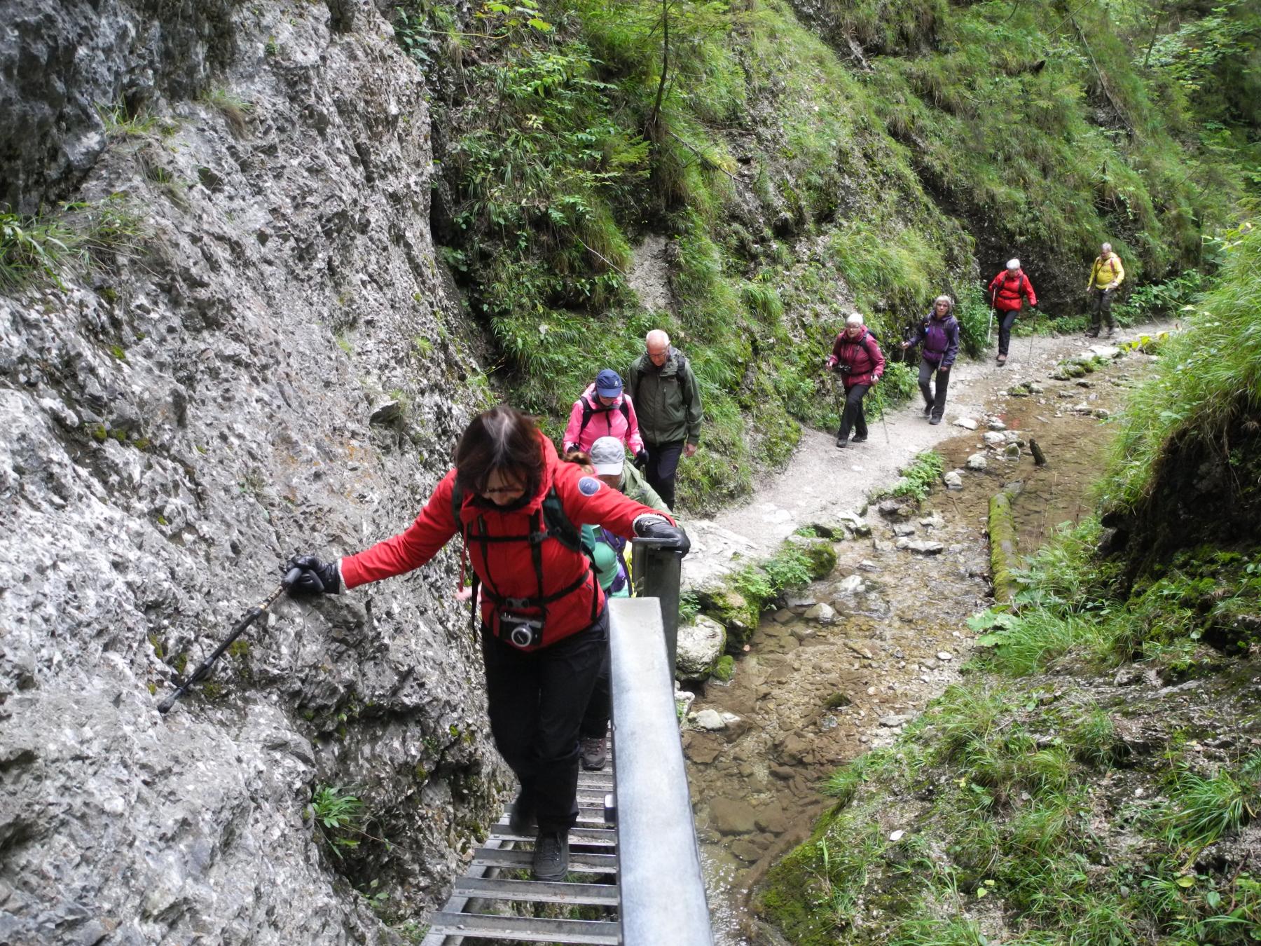
The trail starts either in the Čingov tourist area or in Letanovský mlyn (talk to the mountain leader to choose from where to start) and we soon get into the gorge. The whole trail runs along the stream and sometimes above it. The most beautiful and frequently visited parts of the trail are secured with the ropes (that’s why you’ll need a via ferrata kit). The trail includes waterfalls, crossings over the river and some fallen trees. Rainfalls can cause the stream to rise and the water level on the path can also be higher in certain sections so be sure to wear a good pair of shoes. The rocks can be slippery and poor-quality shoes can make the hike very uncomfortable for you.
Persons per a mountain leader: 6 at maximum.
The trail was prepared by Marcel Kubinský, marcel@kubinsky.sk


Suchá Belá gorge (Slovak Paradise)
Trail: Podlesok tourist area – Suchá Belá gorge
Estimated hike duration: 2-2.5 hours ascent (altogether 4-5 hours)
Height difference: 510 m
Difficulty: A moderately difficult climb with sections secured with technical equipment, bridges, iron cramps, chains and ladders in certain passages.
Admission fee: 2€ entrance fee to the national park
Note: Since a mountain leader has a rope at his disposal when passing through the gorge, he can belay you in case you feel insecure crossing the gorge. Belaying makes the crossing much safer especially for the less experienced hikers and for children. There is also an option to cross the gorge during winter in agreement with the mountain leader who will suggest any necessary equipment.
The hike begins in Podlesok, there is an entry to the gorge after a few meters. The hiking trail leads along the stream the whole time. There are wooden bridges as well as ladders in the narrow parts of the trail. You can look forward to Misové vodopády waterfalls, Korytový vodopád waterfall and Okienkový vodopád waterfall. The stream level is elevated after the rainfalls, the track is full of muddy passages and the rocks may be slippery – that is why it is necessary to have a pair of higher trekking waterproof shoes with Vibram soles. The number of persons per a mountain leader depends on a season: summer – 15 persons at maximum, winter – 6 persons at maximum.
The trail was prepared by Svätojánsky Peter, Marcel Kubinský, svatojan@gmail.com, marcel@kubinsky.sk


Piecky gorge (Slovak Paradise)
Trail: Hrabušická píla – Piecky gorge – Hrabušická píla
Estimated hike duration: 2-2.5 hours ascent (altogether 4-5 hours)
Height difference: 460 m
Difficulty: A moderately difficult hike with technical equipment, bridges, iron cramps, chains and ladders in certain passages.
Admission fee: 2 € entrance fee to the national park
Note: It is not very frequently visited gorge in the Slovak Paradise suitable for less experienced tourist as well as for children. A mountain guide always has a rope and can secure you if necessary. The hike starts at the parking lot in Hrabušická píla (590 m) from where we soon enter the gorge. We hike along the stream all the time. The narrow parts are equipped with wooden and steel footbridges and several vertical ladders. You can also look forward to Veľký & Terasový vodopád waterfalls which are most beautiful in spring or after rains. In case of rainy weather, the water level is usually higher and the path is under water, so waterproof hiking shoes and considerable caution are a must.
The number of persons per mountain guide depends on the season. Summer max. 15 people/winter max. 6 people.
The trail was prepared by Marcel Kubinský marcel@kubinsky.sk


Veľký Sokol gorge (Slovak Paradise)
Trail: Sokol river mouth – Malá Poľana meadow and back by different way
Estimated hike duration: 3-3.5 hours ascent (altogether 6-7 hours)
Height difference: 510 m
Difficulty: A moderately difficult ascent including several sections with wooden and steel footbridges and ladders.
Admission fee: 2 € entrance fee to the national park
Note: Veľký Sokol is not very frequently visited gorge in the Slovak Paradise with almost untouched wilderness. During the hike it is often necessary to pass across the river and over fallen trees. We walk on the old, wet logs and one has to be very careful. A mountain guide always has a rope and can secure the others if necessary. It is also possible to go on a hike in winter when the water is frozen and the waterfalls turn into ice sculptures. Accompanied by a mountain guide, your hike will be safe and unforgettable.
In case of rainy weather, the water level is usually higher and the path is under water, so waterproof hiking shoes and considerable caution are a must.
The number of persons per mountain guide depends on the season. Summer max. 15 people/winter max. 6 people.
The trail was prepared by Marcel Kubinský marcel@kubinsky.sk


Zejmarská roklina gorge (Slovak Paradise)
Trail: Dedinky – Zejmarská roklina gorge – Geravy – Dedinky
Estimated hike duration: 3-4 hours altogether
Height difference: 340 m
Difficulty: A slightly difficult hike suitable for moderately experienced tourists, two parts are secured with chains.
Admission fee: 2 € entrance fee to the national park
Note: It is a pretty frequently visited gorge in the Slovak Paradise. It is the only one with ladders on the southern side and although it is also the shortest one, the nature around is marvelous. From the starting point we follow the path to Mlynky – Biele Vody where the gorge begins. Slightly ascending we get under Nálepkov vodopád waterfall and climb up the ladder. We continue to the meadow of Geravy where we can have a rest and get snacks at the restaurant or the snack bar. We then return to the village of Dedinky following a forest path. It is also possible to cross the gorge in winter when the stream is frozen and waterfalls are transformed into ice sculptures. Accompanied by a mountain guide, your hike will be safe and unforgettable. If you have enough time after the hike, you can also visit the nearby Dobšinská ľadová jaskyňa ice cave which is listed in the UNESCO natural heritage.
The number of persons per mountain guide depends on the season. Max. 15 persons in summer, max. 6 people in winter.
The trail was prepared by Marcel Kubinský marcel@kubinsky.sk


Prielom Hornádu – river valley trail (Slovak Paradise)
Trail: Podlesok tourist area – Letanovský mlyn – Tomášovský výhľad overlook – Čingov tourist area
Estimated hike duration: 5-6 hours altogether
Height difference: 450 m
Difficulty: Easy hike for tourists with a little hiking experience but without fear of height on technical parts on the route.
Note: It is possible to start the route from the opposite side or to do a circuit hike.
The hike starts at Podlesok tourist area (550 m) which serves as a northern entrance to the Slovak Paradise. We practically walk along the border of the forest until we get to the place where the Hornád river enters the valley. This is where we start hiking above the river using steel climbers and chains. The first third of the hike is behind us when we get to Kláštorná roklina ravine which continues ascending to Kláštorisko. However, we follow the path to Letanovský mlyn (535 m) and then ascend steeply along the river to Tomášovský výhľad overlook (640 m). After beautiful views, only the final part of the route to Čingov tourist area (505 m) awaits us.
The trail was prepared by Kubinský Marcel, marcel@kubinsky.sk


Trangoška – Ďumbier peak (2,043 m) – Srdiečko centre (1,210 m) (Low Tatras)
Trail: Trangoška mountain holiday resort (1,100 m) – Ďumbier peak (2,043 m) – Chopok peak – Krížske sedlo saddle – Príslop saddle – Srdiečko centre (1,210 m)
Estimated hike duration: 8.5 hours
Height difference: 1,526 m
Difficulty: A technically simple climb suitable for moderately experienced hikers.
Note: The hike begins at the Trangoška parking lot (1,100 m). We are to follow the green-marked trail. After 45 minutes we walk around a turn heading to Jaskyňa mŕtvych netopierov (Dead Bats Cave). After a while we can see Halašova Jama submersion and after another hour of walking we get to M. R. Štefánik mountain hut (1,746 m) under Ďumbier peak. After another hour we continue across Krúpovo sedlo saddle to Ďumbier – the highest peak of the Low Tatras. Here starts the most spectacular part of the hike – the Low Tatras ridge: the right-hand side offers a view of the Western Tatras and the High Tatras while the left-hand side provides us with great views of Veľký and Malý Gápeľ peaks which are closest to us and Poľana hill and Veporské vrchy hills which are visible in the distance. We then go over to Chopok peak on the alpine trail paved with large stones. There is a possibility to buy a snack in Kamenná chata mountain hut. This is also the easiest way to escape from the ridge to the valley in case of adverse weather conditions. We continue by following the red-marked trail through Poľana saddle to Krížske sedlo saddle from where we begin to descend to Príslop saddle with mountain pines and bilberry cover all around us. Here we can see a side ridge made up of the Mesiačik, Baba and Pálenica peaks in front of us. The ridge belongs to Príslop saddle which is exactly where we are heading. What follows is a narrow traverse to Kosodrevina mountain hut (1,500 m) and a short descent to Srdiečko center.
The trail was prepared by Trajčík Peter, pampo@centrum.sk


Chata Gader – Tlstá hill – Ostrá massif – Chata Gader (Veľká Fatra)
Trail: Chata Gader mountain hut (515) – Tlstá hill (1,373) – Ostrá massif (1,247) – Muráň massif – Chata Gader mountain hut
Estimated hike duration: 6 hours
Height difference: 1,085 m
Difficulty: A technically simple hike suitable for moderately experienced tourists.
Note: The trail is one of the most beautiful one-day trips in Slovakia. The moderately difficult hike begins above the village of Blatnica at Konský dol (515 m). Following the path across the beech forest (the blue mark), we get to the peak of Tlstá hill. A rocky path on the ridge made of limestone and dolomite rocks leads us to the hills Ľubená, Zadná Ostrá and finally to Ostrá. The trail is bordered by steep slopes. The upper part of the trail offers spectacular views of the Turčianska kotlina valley and the Malá Fatra mountain range which are bordered by the rocks of the Muráň and Ostrá massifs. Following the yellow mark we go down to Muráň and across the valley we get back to Gader mountain hut.
The trail was prepared by Trajčík Peter, pampo@centrum.sk


Via Ferrata Dve Veže (Veľká Fatra)
Trail: Nižná Revúca – Via Ferrata Dve veže (Two towers)
Estimated hike duration: 3-4 hours ascent
Height difference: approx. 400 m
Difficulty: Moderately demanding via ferrata suitable for tourists with an adequate physical condition. The greater part of the hike is the via ferrata, which leads across a gorge with technical equipment (steel ropes, iron cramps, climbers, rope bridges). It is necessary to have a via ferrata kit (seating harness, helmet, energy absorber, gloves) – it is possible to borrow it from mountain leader. Via ferrata is suitable for children over 10 years of age.
Note: Let´s try the youngest via ferrata in Slovakia with us and experience something new.
This location is also suitable for via ferrata training courses from beginners to advanced. Via Ferrata Dve veže is the youngest via ferrata built in Slovakia. It was officially opened on September 14, 2019. In fact, it is a small ferrata park including several via ferratas. It is located near the village of Liptovské Revúce, in the Veľká Fatra national park. You can find it in the area that locals usually call "Zahorovo".
There is a total of 9 short ferratas, whose difficulty according to the Schall scale is C/D (difficult/very difficult). The ferratas are not suitable for children under 10 years of age. In total, the via ferrata park includes 380 m of steel ropes, plenty of climbers, and two rope bridges. Every via ferrata has its name and is marked with its difficulty.
From the highest point, you have a beautiful view of the surrounding hills of the Low Tatras (Končitá, Malý Zvolen, Čierna Hora) and the Veľká Fatra mountain range (Krížna, Frčkov). The two national parks are separated by the river Revúca.
Brief information about the Via Ferrata Dve veže:
- Altitude – about 800 m above sea level;
- Elevation of individual roads – from 20 m to 70 m;
- Origin – the rock is of limestone origin;
- Layout – the Ferrata consists of 3 rock towers – one smaller and 2 dominant ones, the towers are connected by rope bridges;
- Possibility of descent – there is a descent path leading to the beginning of the via ferrata;
- The difficulty of via ferrata routes – routes are divided into easy and more challenging ones. Difficulty levels are B, C, and C/D;
The via ferrata also includes an educational trail with information panels full of interesting facts about the local fauna and flora, forestry, etc. The information panels are located along the access path leading to the via ferrata.
Seasonally closed: January 1 – April 30
The trail was prepared by Kračmer Peter, kracmer@skialpkrivan.sk


Main ridge of the Malá Fatra mountains (Malá Fatra)
Trail: Vrátna valley – Veľký Kriváň peak – Chleb peak – Poludňový grúň hill – Stoh hill – Štefanová
Estimated hike duration: 6.5-8 hours or 10 hours (without cable car)
Height difference: 800 m (1,590 m without cable car)
Difficulty: A slightly difficult hike suitable for moderately experienced tourists.
Note: Discover the beauties of the Malá Fatra mountains ascending to the highest peaks of the main ridge. The start of the route is in the Vrátna valley where we can take a cable car and spare us 760 altitude meters of the ascent. From Snilovské sedlo saddle (1,530 m) we then ascend to the highest peak of Malá Fatra – Veľký Kriváň (1,709 m). Having enjoyed a beautiful panoramic view from the top, we return to Snilovské sedlo saddle and hike to the other peaks of the main ridge: Chleb (1,647 m), Steny (1,628 m), Poludňový grúň (1,460 m). We descend to Stohové sedlo saddle (1,225 m) where a slightly difficult ascent to Stoh hill awaits us (1,608 m). However, we can enjoy the beautiful view of the eastern part of Malá Fatra from there. After that we only descend – first to Medziholie saddle (1,175 m) and then to Štefanová (630 m), a picturesque village, where we can get some long-desired snacks and relax.
The trail was prepared by Marcel Kubinsky, marcel@kubinsky.sk


Jánošíkove diery gorges + Veľký & Malý Rozsutec peaks (Malá Fatra)
Trail: Terchová Biely potok bus stop – Nové diery gorge – Podžiar saddle – Horné diery gorge – Medzirozsutce saddle – Veľký & Malý Rozsutec peaks – Medziholie saddle – Štefanová village
Estimated hike duration: 7-8 hours + 1 extra hour for hiking to Malý Rozsutec peak
Height difference: 1,200 m + 140 m Malý Rozsutec
Difficulty: A slightly difficult hike suitable for moderately experienced tourists including chains and ladders in certain passages.
Note: Explore the beauty of the Malá Fatra gorges on our way to the peak of Veľký Rozsutec (1,610 m). The route begins at the bus stop Biely potok (570 m) near the village of Terchová. From there we can comfortably cross a beautiful gorge "Jánošíkove Diery" named after a Slovak national hero, Jánošík, born in Terchová. We cross the gorges of Dolné, Nové a Horné diery with a stop in Podžiar saddle (700 m). After a short break, we continue to Horné Diery gorge and then relax for a while in the saddle of Medzirozsutce (1,200 m). If you are not too tired, it is also possible to "run" up to the peak of Malý Rozsutec (1,344 m) and return back to the saddle. We continue to ascend to Veľký Rozsutec peak (1,610 m). At the end, we descend steeply to Medziholie saddle (1,175 m) and then to the beautiful village of Štefanová (630 m).
The trail was prepared by Marcel Kubinsky, marcel@kubinsky.sk


Via Ferrata of the Mountain Rescue Service to Martinské hole (Malá Fatra)
Trail: Martin Stráne – Ferrata HZS (Via Ferrata of the Mountain Rescue Service) – Martinské hole tourist center – Martin Stráne
Estimated hike duration: 3 hours ascent, 2 hours descent (altogether: 5-6 hours)
Height difference: 785 m
Difficulty: A moderately difficult hike suitable for physically fit hikers. A major part of the trail on our way up is the via ferrata which leads across a gorge provided with the technical equipment (steel ropes, iron cramps, climbers, and a ladder). It is necessary to have a via ferrata kit (seating harness, helmet, energy absorber, gloves) – it is possible to borrow it on the spot. The trail is also suitable for children over 10 years of age.
Note: Crossing the first Slovak ferrata with us will surely be an unforgettable experience.
The trail starts in Martin at the public transport terminus called Stráne (500 m) from where we follow the paved road (the red mark) to the bed of the Mlynský potok stream. Here we get to the lower part of the two-way ascent which ends at the fourth information board. You can find three information boards, four rest places and seven bridges over the stream on our way through this part of the trail. We put our gear on and continue through the upper part – the ferrata, which is only used for the ascent. We go up along the stream to the waterfalls where the trail splits. The option B right in front of us is easier than the option C on our right. Both of them meet at the cross where you can write you name in the visitors’ book. We continue to Bazová hill (1,245 m) and then through the forest to Martinské hole. On the upper part of the trail you can find two information boards, four rest places and three bridges over the stream. In total the ferrata includes 428 m of steel ropes, 170 anchors, 90 climbers, and a ladder.
We can take a break at Martinské hole where both Pirmanka mountain hut and Stará chata mountain hut offer some snacks. We then continue following the yellow mark which leads back to where we started.
It is also possible to complete the tour in the winter, but according to current conditions, we will add crampons and ice axes to the equipment. Seasonally closed: September 15 – October 31 and April 15 – May 31
The trail was prepared by Kračmer Peter, Mgr., kracmer@skialpkrivan.sk


Via Ferratas Skalka (Kremnické vrchy)
Trail: Skalka parking – Skalka overlook – Via Ferratas Skalka
Estimated hike duration: 3-4 hours
Height difference: 400 m
Difficulty: A moderately difficult via ferrata suitable for tourists with an adequate physical condition. The greater part of the hike is the via ferrata, which leads across a gorge with technical equipment (steel ropes, iron cramps, climbers, and a ladder). Ferrata equipment (seating harness, helmet, energy absorber, gloves) is required and you can borrow it from mountain leader. Via ferrata is suitable for children over10 years of age.
Note: This location is also suitable for via ferrata training courses from beginners to advanced. Together with a mountain leader, you can cross the following via ferratas and try new adrenaline attractions:
• You will cross the longest cable bridge in Central Europe, which is 80 meters long and hangs between the rocks up to 45 meters above the ground.
• Via ferrata Jánošíkova diera – difficulty according to the Schall via ferrata scale is A/B, the length is 30 m and elevation is 5 m. It is an ideal via ferrata for children or to try the equipment.
• Zostupovka – difficulty A/B, elevation 70 m, length 150 m. It is used to descend below the via ferratas and it also includes the cable bridge.
• Via ferrata Trubačova veža – difficulty B. The beginning is the same as for the Komín via ferrata. The route then leads to the right to a tower with a cross. Rope bridge is located at the end.
• Komín – difficulty C. It offers several variants such as 8 m long branch called Kominárska. The total elevation is 85 m and the length is 110 m.
• The advanced hikers can also get through the cable climbing net, which is located at the end of the bridge. It is vertical and falls to a depth of 37 meters. It is also the only one of its kind in Slovakia. Its difficulty is D.
• Výzva – so far the most difficult via ferrata in Slovakia with difficulty E. This extremely difficult via ferrata with the elevation of 60 m, the length of 70 m and the 4 m overhang is suitable only for experienced climbers.
Seasonal closure: January 1 – May 31
The trail was prepared by Kračmer Peter, kracmer@skialpkrivan.sk